The third in an ongoing series of conversations, NVTC’s WMATA Board Member Forum is designed…
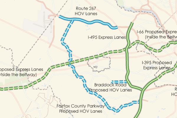
NVTC Maps Current/Proposed BRT & HOT Lanes
To better understand how bus transit is serving the region and to assess future opportunities for high capacity bus service, NVTC is conducting a series of geospatial-based analyses. Last fall, NVTC mapped job accessibility in the region, showing the number of jobs within a 45-minute commute by transit as well as regionally defined activity centers. New NVTC maps help the region visualize opportunities for Bus Rapid Transit. These maps highlight the current, planned and proposed Bus Rapid Transit networks in Northern Virginia and identify the current, planned, and proposed managed lane (HOT) facilities where there are opportunities for expanded commuter and express bus services.
Related Posts